
My latest map project blends technology and history. Many years ago I bought an old Automobile Club of Southern California map of Pasadena. My plan is to first accurately date the map, digitize it and pin it onto Google Earth. Then by searching the archives of the Pasadena Historical Society and other local sources pin photos of what some of the interesting points on the map looked like in about 1920 when the map was printed. I hope then to visit the sites, retake the scenes as they are now and pin those photos to the map also. I hope finally to turn the work into a slide show that has some intriguing history and also demonstrates the new technology for presenting it.

According to the back of the map the Auto Club slogan in about 1920 was “Good Roads.”
To illustrate what the process will be like zoom in on Arcadia and see the Ross Field Balloon School.
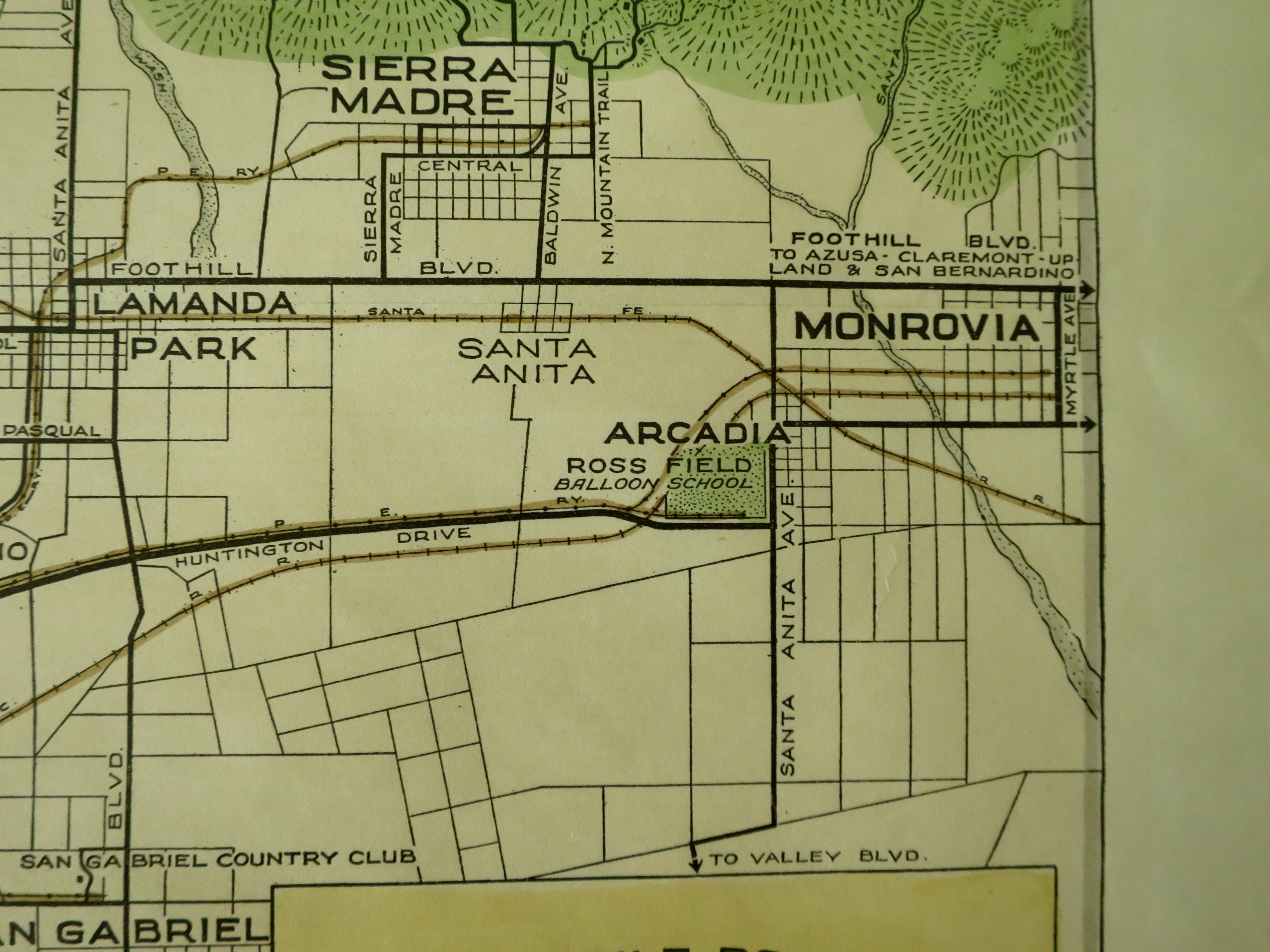
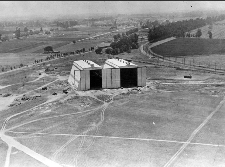
And here is a photo from about 1918 that shows the Balloon Field in what is now the county park in Arcadia.
Other places that are shown on the map that I hope to include are:
Mission Lake
Orchard Camp
Rose Bowl
Cawston Ostrich Farm.
Busch Gardens.
Echo Mountain
Mt Wilson Toll Rd.
Tournament Park
Pasadena High School.
Selig Zoo
You can zoom in on the big map above to find all of these 1920’s landmarks of the Pasadena area.